
Topographical Landscapes – mountains
August 21, 2015
Mountains
Definition: A mountain is a large land-form that stretches above the surrounding land in a limited area, usually in the form of a peak. A mountain is generally steeper than a hill.
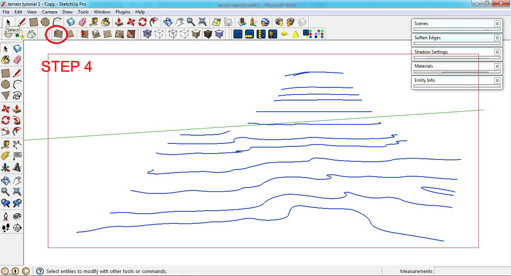
1. Draw/plot contour lines.
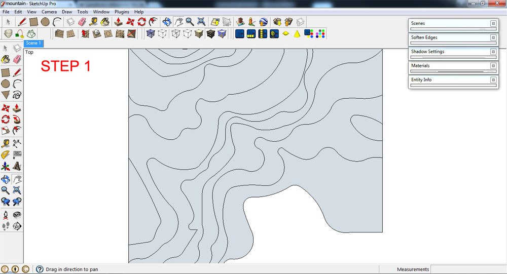
Draw contour lines
2. Delete any faces that formed when lines were drawn.
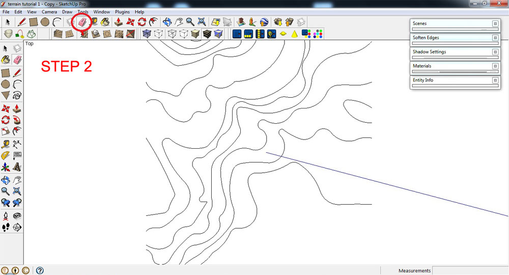
Delete Faces
3. To adjust the elevation of contour lines, use the Move Tool. Click a specific contour line that you want to adjust, then click the Move Tool> press the up key button (keyboard)> pull-up the selected contour line or object vertically (it is locked to the blue axis). You can add a specific height, if you wish, in the Measurements Toolbar. Type the value in the Measurements Toolbar (SketchUp will automatically display what you type in the Measurements Toolbar), and press the Enter (Microsoft Windows) or Return (Mac OS X) key.
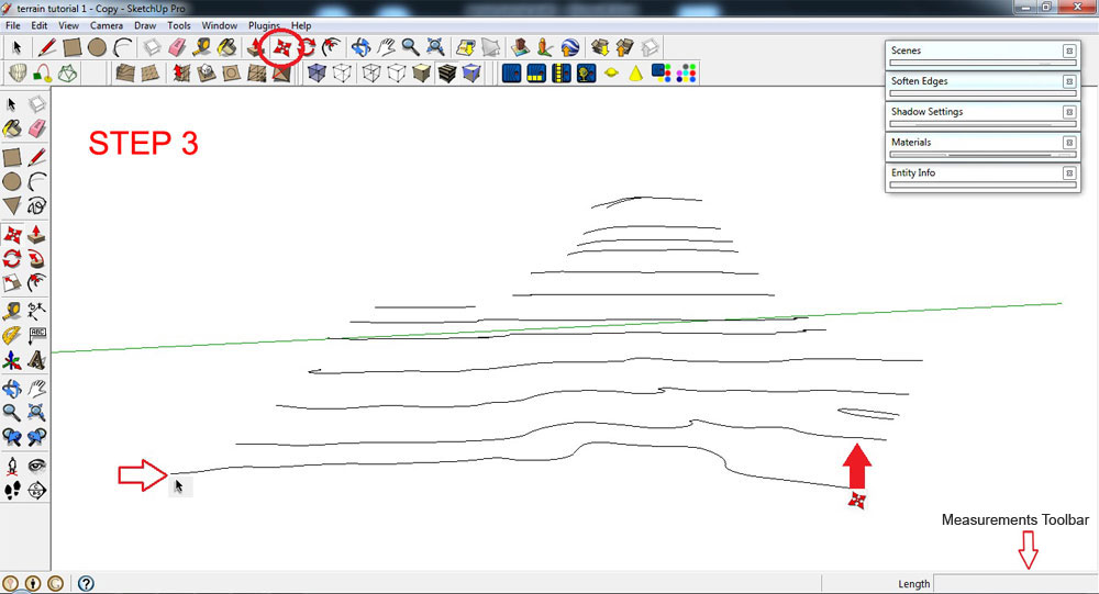
Adjust the elevation of your contour lines
4. Ctrl+A (select everything that isn’t hidden). Using the Sandbox Tool, click the icon ‘From Contours’ or go to Draw>Sandbox>From Contours. This process will automatically generate 3D object(s).
Select all and use Sandbox Tool
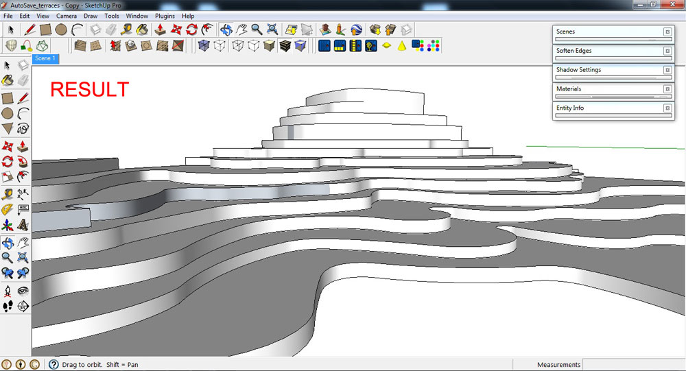
This is the result.
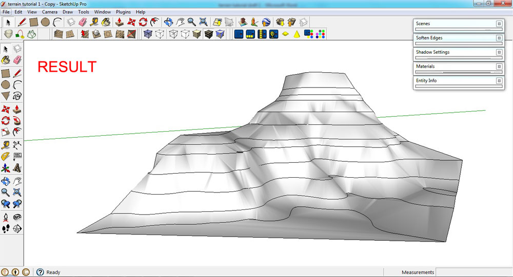
Result
5. Using the Move Tool, drag the 3D model away from the contour lines.
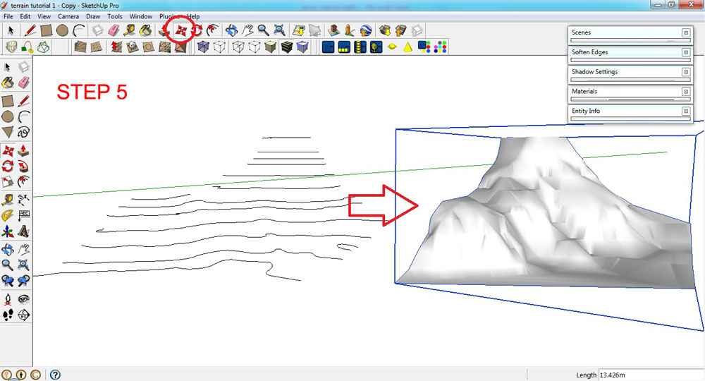
Drag 3D model away from the contour lines
6. Apply grass texture using Paint Bucket Tool.

Apply grass texture
Summary
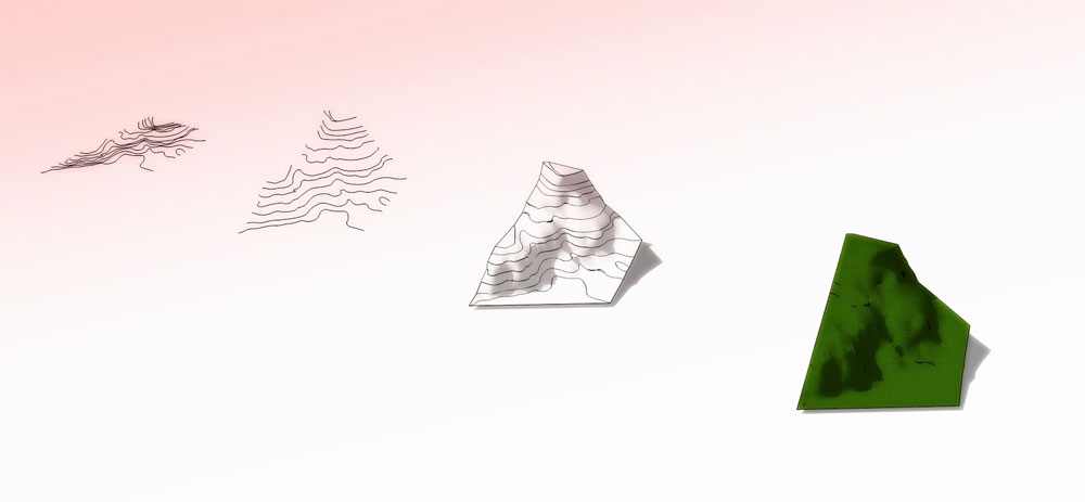
Summary
Thanks for reading!
Benedict Caliwara Ctrl+A (select object)> Using the sandbox tool, click the icon “from contours.” This process will automatically generate 3D object(s).
Topographical Landscapes – terraces
August 19, 2015
 Terraces
Definition: Terraces is a piece of sloped plane that has been cut into a series of successively receding flat surfaces of platforms, which resemble steps, for the purpose of more effective farming. This type of landscaping, therefore, is called terracing. Graduated terrace steps are commonly used to farm on hilly or mountainous terrain. Terraced fields both decrease erosion and surface runoff, and may be used to support growing crops that require irrigation, such as rice.
1. Draw or plot contour lines (make sure to retain all the surfaces).

Draw or plot contour lines
2. Select the surface.
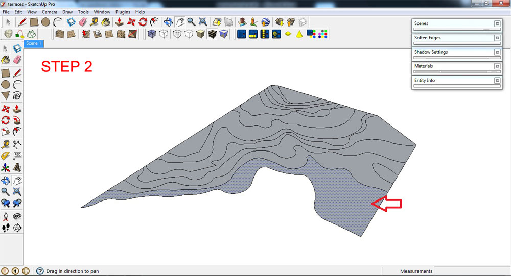
Select the surface
3. Adjust the elevation of the selection by using the Push/pull Tool.
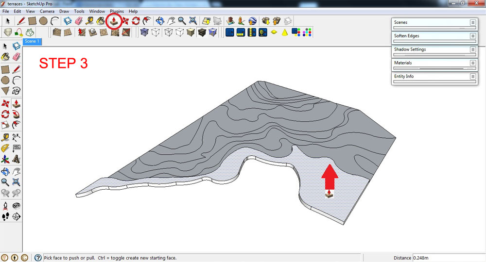
Adjust the elevation with Push/pull Tool
This is the result, repeating multiple use of the Push/pull Tool.
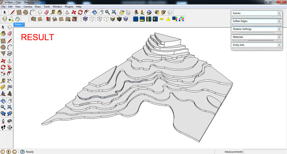
Repeat multiple use of the Push/pull Tool
4. Soften all vertical Edges . To do that, click Ctrl+ Erase Tool.
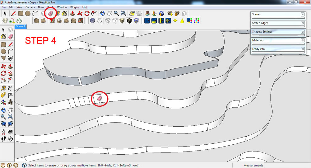
Soften all Edges
This is the result after tidying up the model.
Result after tidying up the model
5. Ctrl+A (select everything that isn’t hidden)> right click> “Make Group”.
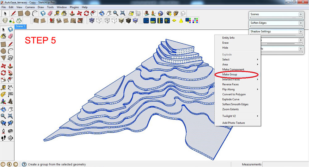
Make model into a Group
6. Apply grass texture to your grouped model using Paint Bucket Tool. Choose any available grass textures from the Materials dialogue box.
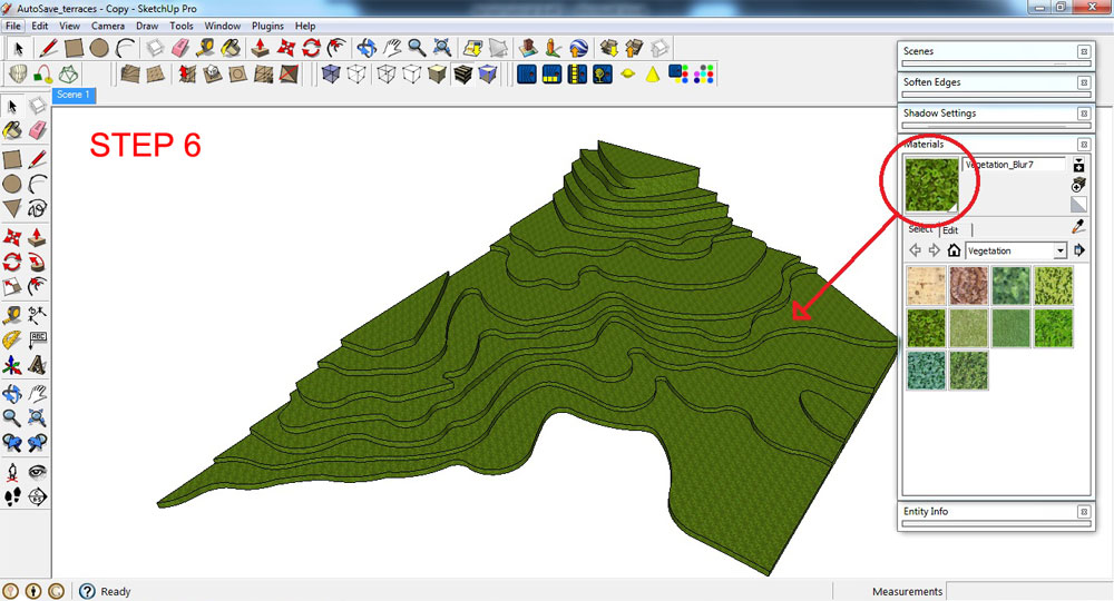
Apply grass texture to your grouped model
Summary
Summary
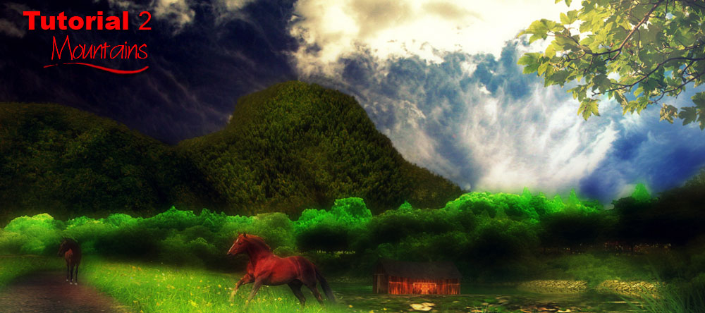
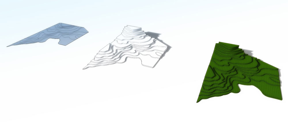
What you can achieve with final render output and post-processing.
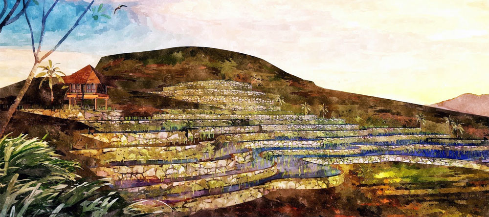
Final image
Thanks for reading!
Benedict Caliwara
Profile Builder 4

Artisan Organic Toolset

PlaceMaker Version 3
Skimp Pro Import Extension

BIM Bundle Special Offer!
SketchPlus Artist Bundle !
Bevel Tool
V-Ray 5 for SketchUp E-Book