PlaceMaker – the Instant 3D City Builder

Stop wasting your project budget on creating site context. PlaceMaker automates the creation of your site model with a simple mouse stroke!
You have a tighter budget, a shorter deadline and clients who want to implement changes immediately to their designs. There is a solution that will not only save you time, but will also increase your productivity with a simple desktop plugin…PlaceMaker for Modeling, Design and Rendering.
SketchUp PlaceMaker is a plugin (extension) for the 3D modeling program SketchUp. PlaceMaker imports into SketchUp a variety of 3D data, aerial images and unique geographical features.
Quick and easy to use, PlaceMaker saves time and money. What would take days, if not weeks, can be done in minutes.
PlaceMaker brings in detailed 3D cities from around the world including terrain, roads, walks, buildings, rails, trees. matchless aerials, textured meshes and more!
PlaceMaker Imports Rich 3D and 2D Models and Data Like these Examples…
One of PlaceMaker’s most popular features are the High resolution aerials from Mapbox and Nearmap. Get unprecedented imagery quality for many locations around the world. Mapbox provides global coverage, with sharp imagery for most major world cities. Nearmap’s almost 3.5cm resolution and recency is a game changer for modeling and presentation.
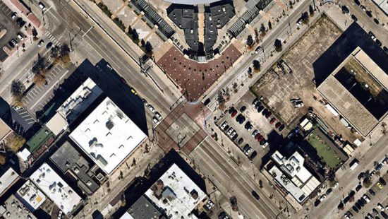
HIGH RESOLUTION AERIALS
PlaceMaker now offers access to high quality terrain from Cesium. The high quality terrain adds a new level of accuracy and granularity to terrain models. Terrain resolution varies by location. The coverage is global and the results detailed. You can even drape aerials, 3D buildings, roads and other infrastructure onto the terrain surfaces.
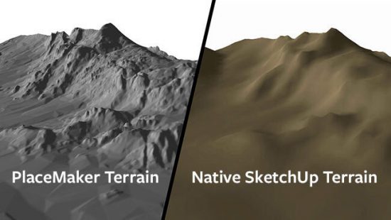
HIGH QUALITY TERRAIN
40 hours of work in 4 minutes! Quick, full of detail and easy to use, the popular PlaceMaker Extension for SketchUp lets you import 3D building massings, road and walk surfaces, high resolution aerials, trees, water and more. It’s global data for cities and towns AROUND the WORLD.
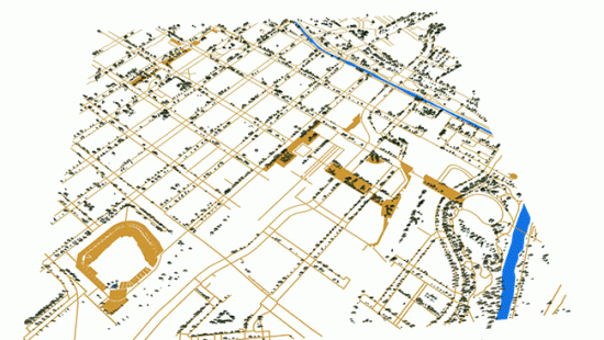
3D CITIES AND INFRASTRUCTURE
Digitizing the world with Artificial Intelligence. PlaceMaker is happy to bring you SmartSite; top of the class, next generation vector data. Using AI, SmartSite takes high-resolution aerials and transforms them into accurate site plans that include roads, walks, paths, sports fields, parking areas, bridges, highways, lawns, open spaces and much more.
Available in SketchUp and DWG (CAD) formats. Does not require the purchase of the PlaceMaker Plugin.
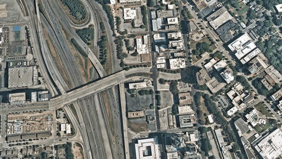
AI GENERATED SURVEYS
Google Earth’s 3D models and mesh envy no more!
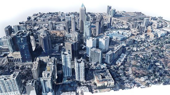
GOOGLE EARTH 3D
PlaceMaker was designed by a respected and established Landscape Architect; as a desktop plugin for SketchUp, that gives you an INSTANT 3D City Builder at your fingertips. So, that 40 hours of work that you have ahead of you, just got cut down to 4 minutes!
PlaceMaker works with any city, any aerial, any road or path on Terrain. PlaceMaker saves you time. Time is money. So, go on, check it out and see how PlaceMaker will simplify your work load and free up some of your time.
SketchUp PlaceMaker Subscription Bundle
SketchUp PlaceMaker Pay-As-You-Go Plus 100 Credits

Revit PlaceMaker Subscription Bundle

Pay-As-You-Go
This option allows you to download the extension for free. OpenStreetMap and Microsoft data (buildings, roads, paths, trees, water) can be previewed for free at the location of your choice, but you will need to purchase credits (starting at $20 for 100 credits) to import the models, aerials, and terrain for a chosen location. Your license and credits do not expire and will automatically transfer if you purchase a subscription in the future!
Subscription Bundle
PlaceMaker can be purchased as an annual subscription which comes bundled with 1000 Credits! The Subscription provides access to much of the data for free (does not require any credits) or at a discount. You’ll also receive the Building Bundle Component Library for FREE! If you purchased credits using a Pay-As-You-Go license, any remaining credits will transfer over to your new subscription automatically. You also get a discount each year when renewing your subscription!


